Enough of Hygge - 5 - Nørrebro and Østerbro

Assistens Cemetery.
Fælledparken.
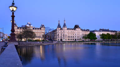
The Lakes.

Introduction
The Nørrebro and Østerbro districts of Copenhagen lie outside the shield of the old City fortifications. The names refer to the northern and eastern "boroughs" across the Lake defences.
These districts exploded as residential areas after 1852 when the City of Copenhagen abandoned its defensive demarkation line that limited the extent of the City. Today Nørrebro is multicultural and edgy, while Østerbro is the more genteel of the two. Historically Østerbro has been the smart place to live, and many of its apartment blocks have richly decorated facades which are worth keeping an eye out for.
The district of Østerbro extends beyond the railway line to encompass the harbour at Nordhavn and the beach at Svanemøllestrand - and we will visit these in a later excursion up the coast.
The following tour winds through the two districts to give a taste of the past and the present. It is a tough ask to make a flowing tour that visits the best sites, so there are many twists and turns.
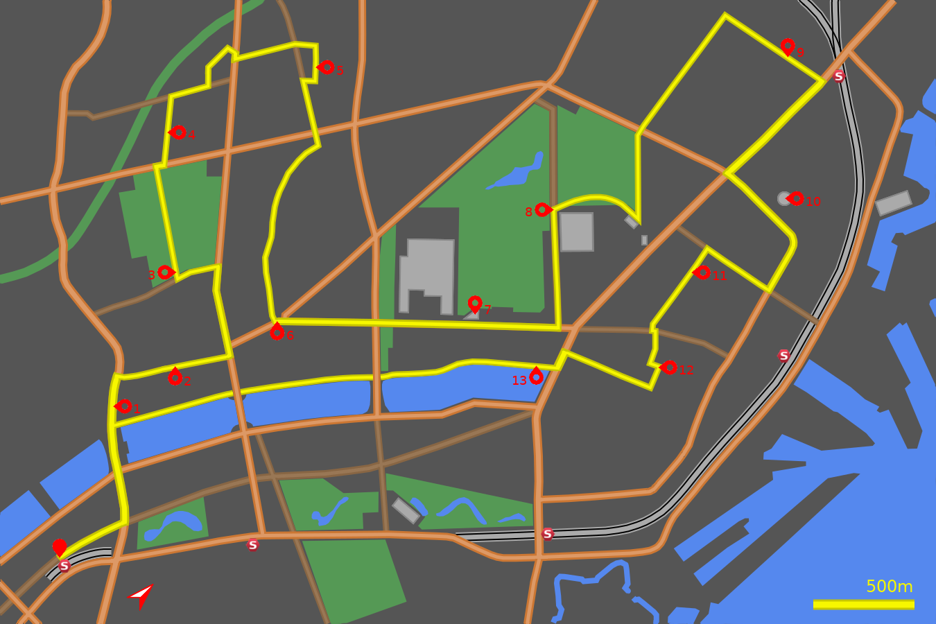
Note: The map (above) and photographs can be enlarged by clicking on them (opens in a new browser tab). On the map north is 45° clockwise, i.e. at 01:30 on an old school analogue clock.
![]() tart:
tart:
Start at the western side of the Vesterport Station on Vester Farimagsgade. (GPS 55.67663 12.56220).
![]() Proceed in a northerly direction along Vester Farimagsgade until you reach
the major junction with H. C. Andersens Blvd
(GPS 55.67968 12.56362).
Cross to the other side and turn left along the dual carriageway, which is
now called Gyldensløvsgade.
At the next major junction the vista broadens with lakes to the left and right.
Go straight across the junction to cross the between the lakes.
Confusingly the road changes name again to Åboulevard
(Å means river)
Proceed in a northerly direction along Vester Farimagsgade until you reach
the major junction with H. C. Andersens Blvd
(GPS 55.67968 12.56362).
Cross to the other side and turn left along the dual carriageway, which is
now called Gyldensløvsgade.
At the next major junction the vista broadens with lakes to the left and right.
Go straight across the junction to cross the between the lakes.
Confusingly the road changes name again to Åboulevard
(Å means river)
Åboulevard and Blågårdsgade
![]() 1
Where the lake ends take the straight ahead cycle lane to continue down
the wide Åboulevard
(GPS 55.68234 12.55772).
Soon you
pass the front of Bethelhems Church. The body of the church is hidden
within the block of apartments but the front is distinctive. It was designed
by Peder Jensen Klint who also designed the fabulous Grundtvig's Church
that we will meet in the next chapter.
1
Where the lake ends take the straight ahead cycle lane to continue down
the wide Åboulevard
(GPS 55.68234 12.55772).
Soon you
pass the front of Bethelhems Church. The body of the church is hidden
within the block of apartments but the front is distinctive. It was designed
by Peder Jensen Klint who also designed the fabulous Grundtvig's Church
that we will meet in the next chapter.
After a small road junction another site to look out for is the Drowning Stone, about 50m after that junction, between the cycle track and the road. It is easy to miss, but it commemorates an accident in 1812 where a coach with wedding guests plunged into the icy river and two people drowned. The river they drowned in now lies beneath the road - and explains why Åboulevard meanders like a river in comparison to other streets hereabout.
At the next set of traffic lights turn right onto Blågårdsgade (GPS 55.68421 12.55522). After 150m Blågårdsgade turns into a pedestrian zone, however beneath the blue sign (Gågade zone) is another that says "Kørsel tilladt" which means you are permitted to "drive" along it - but carefully as pedestrians have prioirty and there is a speed limit of 15 kph.
![]() 2
Blågårdsgade is full of café's and bars where people
sit out in the afternoons and evenings to suck in the atmosphere and return
it having contributed their share. Continue along it and you shortly come
upon the square of Blågårds Plads. Of interest are
the 22 sculptures by Kai Nielsen surrounding the sunken court, that depict
the trades and life of working people. On the north-east side of the square
is the Concert Church (Koncertkirken) which is a music venue for all genres.
2
Blågårdsgade is full of café's and bars where people
sit out in the afternoons and evenings to suck in the atmosphere and return
it having contributed their share. Continue along it and you shortly come
upon the square of Blågårds Plads. Of interest are
the 22 sculptures by Kai Nielsen surrounding the sunken court, that depict
the trades and life of working people. On the north-east side of the square
is the Concert Church (Koncertkirken) which is a music venue for all genres.
Continue along Blågårdsgade weaving between the tables of the outdoor café's, until you come to the junction with Nørrebrogade. Carefully cross the road and turn left to head north-west along Nørrebrogade (GPS 55.68812 12.56017).
Nørrebrogade
Nørrebrgade is the main artery of the district, artery in more ways than simply the highway, but also as in the lifeblood and vitality. This is the shopwindow for multiculturalism in the City - the sights, sounds and smells.
At the next set of lights go straight over into a bus and cyle only section. Keep going over a few more side junctions until the obvious wall and trees of Assitens Cemetery come into view to the left. At the traffic lights turn left into Kapelvej (GPS 55.69056 12.55459).
Continue along Kapelvej with a quick shimmy left and right, until the entrance to Assitens Cemetary appears on the right, over cobbles, and marked by a twin row of poplar trees and a brick gateway, just before a small childrens playground (GPS 55.68879 12.55299).
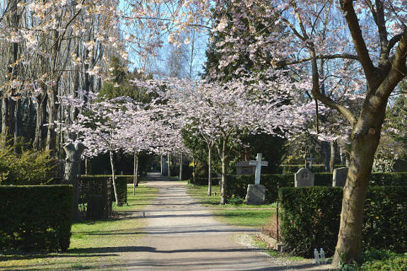
Assistens Kirkegård
![]() 3
Assistens Cemetery is open daily from 7am until 10pm (in winter 7am until 7pm).
As well as being an active cemetary it is also used as a peaceful park for
people to wander about and relax in. Cycling is allowed along this main
poplar lined avenue. The graves of perhaps the most famous Danes since
Viking times are buried here: Hans Christian Andersen and Niels Bohr to the
left and Søren Kierkegaard to the right.
It is a special place that doesn't bear the usual weight of a cemetery -
for instance the sculpture on the family grave of Leif Sylvester Petersen
entitled Det var det (That's it) is guaranteed to raise a smile.
3
Assistens Cemetery is open daily from 7am until 10pm (in winter 7am until 7pm).
As well as being an active cemetary it is also used as a peaceful park for
people to wander about and relax in. Cycling is allowed along this main
poplar lined avenue. The graves of perhaps the most famous Danes since
Viking times are buried here: Hans Christian Andersen and Niels Bohr to the
left and Søren Kierkegaard to the right.
It is a special place that doesn't bear the usual weight of a cemetery -
for instance the sculpture on the family grave of Leif Sylvester Petersen
entitled Det var det (That's it) is guaranteed to raise a smile.
The exit from Assistens Cemetery through the gate at the far end of the main avenue deposits you abruptly onto Jagtvej. Directly ahead is the fashionable street of Jægersborggade. It is jam packed with art galleries, shops, jewellers, bars and cafés. Unfortunately for our needs it cannot be used as it is a one-way street heading the wrong way, as well as being roughly cobbled, but if trendy is your thing then make a detour. We will take the next road along, so turn right out of the cemetery and at the first road on the left (Bjelkes Allé) carefully turn left across Jagtvej (GPS 55.69196 12.54613).
![]() 4
Halfway down Bjelkes Allé you come across Anna's Church. If you had been
on the look-out earlier you will notice some similarities in the brickwork
with Bethlehem's Church - which is no suprise as they were both designed by
Peder Jensen Klint.
4
Halfway down Bjelkes Allé you come across Anna's Church. If you had been
on the look-out earlier you will notice some similarities in the brickwork
with Bethlehem's Church - which is no suprise as they were both designed by
Peder Jensen Klint.
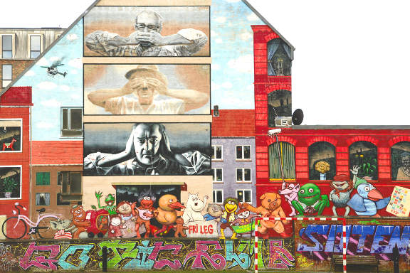
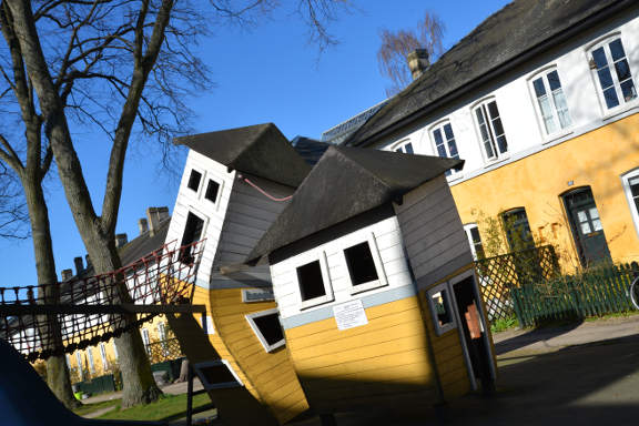
At the end of Bjelkes Allé turn right onto Stefansgade (GPS 55.69434 12.54275). Across the way is an imaginative playground with sunken boats and aeroplanes, and beyond The Green Way. At the crossroads with Søllerødgade turn left (GPS 55.69578 12.54414). On the apartment gable is a fun artwork by GR170 clearly depicting some of the activities that take place in Nørrebro.
At the end of Søllerødgade turn right onto Nordbanegade and where this meets Hillerødgade turn right again to the junction with Nørrebrogade (GPS 55.69767 12.54380). Turn right at the lights onto Nørrebrogade, then immediately move into the bicycle filter lane turning left into Ægirsgade. Carefully cross Nørrebrogade and continue down Ægirsgade.
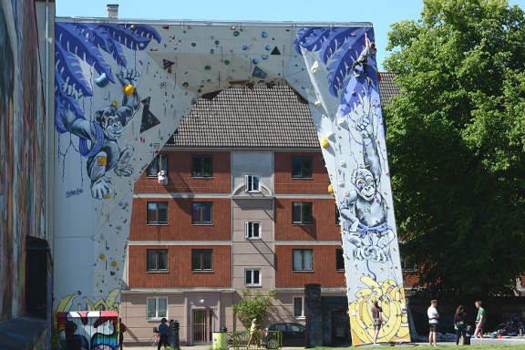
BaNanna Park
After 300m, continue over the crossroads with Mimersgade to the next junction with Nannasgade. Turn right onto Nannasgade (GPS 55.70036 12.54785).
![]() 5
After 100m BaNanna Park opens up on the left. Although small it is packed
with street art and has an impressive climbing arch over the entrance, run
by Nørrebro Climbing Club.
5
After 100m BaNanna Park opens up on the left. Although small it is packed
with street art and has an impressive climbing arch over the entrance, run
by Nørrebro Climbing Club.
Continue to the end of Nannasgade, turn right onto Rådmandsgade and first left at the junction onto Mimersgade (GPS 55.69886 12.54913). At the main crossroads with Jagtvej go straight over, (very briefly Arresøgade) and at the junction, with the sports pitch ahead of you, turn right onto Guldbergsgade (GPS 55.69737 12.55346).
If you have successfully negotiated your way to here then congratulate yourself; the next few sections should be a breeze. Guldbergsgade curves gently southward. Keep on this road crossing any junctions you meet. Approaching Møllegade you pass the Empire Cinema (Bio) on your right, which also houses the Brus brewery (GPS 55.69241 12.55648). Cross Møllegade passing the walled Jewish "Mosaisk" Cemetery on your right. Contine along Guldbergsgade until it opens out at Sankt Hans Torv (St John's Place).
![]() 6
At the junction turn left onto Sankt Hans Torv
(GPS 55.69047 12.56080).
Sankt Hans Torv is reknowned for its café culture, and also the domineering
granite sculpture at its centre.
6
At the junction turn left onto Sankt Hans Torv
(GPS 55.69047 12.56080).
Sankt Hans Torv is reknowned for its café culture, and also the domineering
granite sculpture at its centre.
Blegdamsvej
At the next set of lights carry straight on to Blegdamsvej. Blegdamsvej is named after the bleaching ponds that were used to treat textiles in the 18th century. It is a street with a split personality, on the south side are characteristic 5 storey appartments and offices, and on the north side a succession of dramatic, if not always pretty, buildings and campuses. After St. John's Church comes the Mærsk Tower and the Panum Institute. On the other side of the major junction with Tagensvej comes the emormous campus of the Rigshospitalet (Kingdom Hospital).
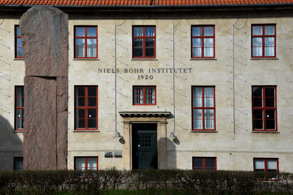
![]() 7
After a few trees marking an entrance to Fælledparken
(The Commons), comes the retiring, but historically important, Niels Bohr
Institute. Following this comes the austere Freemason's Hall and then the
Red Cross Offices. This stretch finishes at the new Trianglen Metro Station.
7
After a few trees marking an entrance to Fælledparken
(The Commons), comes the retiring, but historically important, Niels Bohr
Institute. Following this comes the austere Freemason's Hall and then the
Red Cross Offices. This stretch finishes at the new Trianglen Metro Station.
At the first major set of lights, where The Triangle opens up, turn left onto Øster Allé (GPS 55.69921 12.57668).
As you head up Øster Allé first on the right is what looks like a prison but is in fact an old electricity power station. On the left in the stylish old Post Office building is the Enigma Museum of Communication.
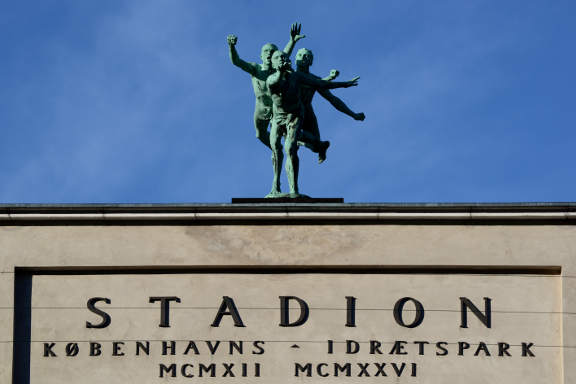
Next on the right is the pretty Brumleby housing development, built after a cholera epidemic broke out in the overcrowded City in 1853. Then comes the domineering presence of Parken, the national football stadium and home to F.C. Copenhagen. It will also play host to matches in the 2020 European Championship.
Fælledparken
![]() 8
Where Parken ends Fælledparken begins.
To the north, west and south the park opens out - there are all sorts
of sports, playgrounds and activity centres to be found - plenty of
opportunities for more exercise, or to find a space for a rest.
When you are ready to continue take the cycle path (called Filosofgangen)
that branches off from Øster Allé at the north-west
corner of the football stadium
(GPS 55.70276 12.57014).
Follow this as it curves round the athletics stadium and into the road /
car park of Gunnar Nu Hansens Plads. Opposite the red brick sports stadium
our route turns left onto Serridslevvej
(GPS 55.70491 12.57515).
but you may wish to look around the next bend at the neo-classical style of
the swimming hall (Øbro Hallen).
8
Where Parken ends Fælledparken begins.
To the north, west and south the park opens out - there are all sorts
of sports, playgrounds and activity centres to be found - plenty of
opportunities for more exercise, or to find a space for a rest.
When you are ready to continue take the cycle path (called Filosofgangen)
that branches off from Øster Allé at the north-west
corner of the football stadium
(GPS 55.70276 12.57014).
Follow this as it curves round the athletics stadium and into the road /
car park of Gunnar Nu Hansens Plads. Opposite the red brick sports stadium
our route turns left onto Serridslevvej
(GPS 55.70491 12.57515).
but you may wish to look around the next bend at the neo-classical style of
the swimming hall (Øbro Hallen).
Continue along Serridslevvej, with Fælledparken on your left, to the major crossroads with Jagtvej (GPS 55.70780 12.57034). Go straight across this onto Vennemindevej. Continue north along Vennemindevej, across several junctions to where it opens out on the left, where Kildevælds Church comes into view. Turn right onto Kildevældsgade just before the main road junction ahead (GPS 55.71400 12.56865).
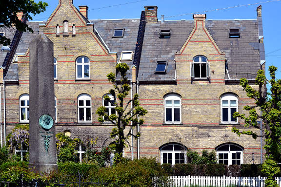
Kildevældsgade
![]() 9
Head straight down Kildevældsgade and suddenly
after the junction with Thomas Laubs Gade the character changes. This
estate of town houses was built at the turn of the century by the
Workers' Building Society, who were also responsible for the Humleby in
Vesterbro. The design in yellow brick with red brick details is broken
up with gable end houses every so often, with double gables on corners.
Halfway along a small square with central garden provides a focus
9
Head straight down Kildevældsgade and suddenly
after the junction with Thomas Laubs Gade the character changes. This
estate of town houses was built at the turn of the century by the
Workers' Building Society, who were also responsible for the Humleby in
Vesterbro. The design in yellow brick with red brick details is broken
up with gable end houses every so often, with double gables on corners.
Halfway along a small square with central garden provides a focus
This pleasant diversion ends abruptly at Østerbrogade. Turn right here (GPS 55.71476 12.57749). Proceed down Østerbrogade passing Sion's Church and Tower on the left. After a further 200m you come to a main junction with Jagtvej to the right. Turn left here onto Strandboulevarden (GPS 55.70918 12.57750).
![]() 10
Strandboulevarden has a central reservation which was originally a promenade
then a tram line and now car parking. At the second junction on the left
(Sæbygade) the view opens up of the
Østre Gasværk Teater. As the name suggests this is
an old gasometer that has been converted into a theatre. And where
Strandboulevarden bends to the right the Svanemølle
power station shows itself between blocks
(GPS 55.70905 12.58466).
10
Strandboulevarden has a central reservation which was originally a promenade
then a tram line and now car parking. At the second junction on the left
(Sæbygade) the view opens up of the
Østre Gasværk Teater. As the name suggests this is
an old gasometer that has been converted into a theatre. And where
Strandboulevarden bends to the right the Svanemølle
power station shows itself between blocks
(GPS 55.70905 12.58466).
At the second set of lights on this southward stretch of Strandboulevarden turn right onto Århusgade (GPS 55.70674 12.58601). Note the striking Hans Just building on the left. Pass the green triangle of Århus Plads and at the traffic lights on Randersgade turn left (GPS 55.70617 12.58054).
Bopa Plads
![]() 11
You soon reach another triangle of green - Bopa Plads - a popular square
with cafés and galleries. This was so named to commemorate the Danish
resistance movement in the second world war (Borgerlige Partisaner).
Continue south on Randersgade until the T junction with Nordre Frihavnsgade.
Cross this staggered junction (left then right) onto A.L. Drewsens Vej
(GPS 55.70205 12.58215).
The road ahead is soon blocked for cars, but take the land ahead, noting
the world war 2 bunker on the right.
11
You soon reach another triangle of green - Bopa Plads - a popular square
with cafés and galleries. This was so named to commemorate the Danish
resistance movement in the second world war (Borgerlige Partisaner).
Continue south on Randersgade until the T junction with Nordre Frihavnsgade.
Cross this staggered junction (left then right) onto A.L. Drewsens Vej
(GPS 55.70205 12.58215).
The road ahead is soon blocked for cars, but take the land ahead, noting
the world war 2 bunker on the right.
![]() 12
We now enter the posh neighbourhood
of Rosenvænget, established over 150 years ago.
Turn left onto Rosenvængets Hovedvej, and then
first right onto Rosenvængets Allé.
At the next T junction turn right (still
Rosenvængets Allé)
(GPS 55.70007 12.58499).
Pass the stylish white apartment blocks on the left and straight across
the junction with Saabyesvej. The next section of
Rosenvængets Allé is cobbled (not too bad)
so grind your teeth and continue to the main junction with
Østerbrogade.
12
We now enter the posh neighbourhood
of Rosenvænget, established over 150 years ago.
Turn left onto Rosenvængets Hovedvej, and then
first right onto Rosenvængets Allé.
At the next T junction turn right (still
Rosenvængets Allé)
(GPS 55.70007 12.58499).
Pass the stylish white apartment blocks on the left and straight across
the junction with Saabyesvej. The next section of
Rosenvængets Allé is cobbled (not too bad)
so grind your teeth and continue to the main junction with
Østerbrogade.
The Lakes
Turn left onto Østerbrogade and after 100m turn right onto the shared bicycle and foot path (Sortedam Dossering) that bounds the north side of the Sortedams Lake (GPS 55.69783 12.57873).
![]() 13
The Lakes have been used as both reservoirs and as part of the City
fortifications. Today they are valued for their recreational worth.
The north side is mostly car-free and in immensely popular. Take the
shared bicycle and foot path until opposite Bird Island, where the bicycle
track joins the road. Use the road along the lakeside until just before
the bridge (Fredensbro)
(GPS 55.69259 12.57002).
13
The Lakes have been used as both reservoirs and as part of the City
fortifications. Today they are valued for their recreational worth.
The north side is mostly car-free and in immensely popular. Take the
shared bicycle and foot path until opposite Bird Island, where the bicycle
track joins the road. Use the road along the lakeside until just before
the bridge (Fredensbro)
(GPS 55.69259 12.57002).
To avoid the main road take the cycle subway on the left and pop up on the far side to continue along the lakeside. Another island (Fish Island) is passed on this stretch before another bicycle subway takes you under Dronning Louises bridge. Keep to the lakeside until you reach the next major road. We have now returned to our outward leg (GPS 55.68234 12.55772).
Cross the wide junction to turn left back down Gyldensløvsgade to the junction with Vester Farimagsgade (GPS 55.67968 12.56362). Turn right onto Vester Farimagsgade to return to Vesterport Station.
Notes on Niels Bohr:
Niels Bohr (1885-1962) is undoubtedly the most important Danish scientist of the 20th century. He made ground-breaking contributions to atomic theory (for which he received the Nobel Prize in 1921), and to quantum theory.
He created the Institue for Physics on Blegdamsvej and the world's leading physicists visited Bohr there, including Einstein and Heisenberg. The Copenhagen interpretation of quantum physics was developed there - this is the interpretation that says that Schrödinger's cat is both alive and dead at the same time - and it is still being argued over today, which means the poor cat still doesn't know its fate.